Diep Son: the path in the photos is gone, and how to vet a tour
The famous 800 m sandbar was destroyed by a typhoon in 2017; what is left runs about 400 m. It only surfaces with the tide, and the tide slips about 50 minutes a day — so a tour's departure time tells you by itself whether anyone timed it.
This piece has no expiry date, but it was written on the date above. Prices, opening hours and street names may have moved on; ring ahead about anything that matters.
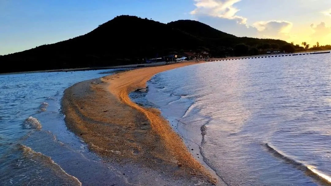
Reference photo
Diep Son sells on exactly one photograph: somebody walking through the sea on a white ribbon of sand, water on both sides, no boat, no bridge. The photograph is real. The problem is that most of the ones being used to sell tours show a path that no longer exists.
The cluster has three main islands, named after birds: Hòn Bịp, Hòn Ó (also Hòn Đuốc, or Phật Nằm) and Hòn Quạ (Hòn Giữa). Before November 2017 there were two bars. The one about 800 m long joining Hòn Quạ to Hòn Bịp was the one that made the place famous, and typhoon No. 12 in 2017 destroyed it. What remains is a bar of roughly 400 m between Hòn Ó and Hòn Quạ. Still a sand path through open water, still worth the trip; simply less than half the length of what made the place famous.
The second thing, and it decides the whole day: the bar only surfaces as the tide falls. Go at the wrong hour and it is under water and there is no path at all — still a quiet island with clear water, but not the thing you booked. Nobody has cheated you in that case; the itinerary said “visit Diep Son” and you visited Diep Son.
Which yields a very compact test. The tide slips about 50 minutes a day, so today's low water is not tomorrow's, and over a month it sweeps through nearly every hour of the day. It follows that a tour departing at the same time every day of the year cannot be timing the tide — it is timing the minibus. So ask before paying — “on my date, when is low water, and when does pickup leave?” — and a seller genuinely running trips out there will answer with two different numbers for two different days.
Three more questions worth asking, because they are where the price difference usually hides. What takes you across: a speedboat or a fisherman's wooden boat — if the itinerary does not say, ask, because they differ in time, in price and in whether anyone is insured. Lunch, because there is almost nothing to buy on the island, so it is either provided or carried.
The third is whether anything else is bolted on. Many trips pair Diep Son with a beach along the way, and that “beach” can be a ticketed resort strip with chairs and shade, or an open stretch of shore with nothing on it. Both are called a beach.
On getting there: the islands sit in Van Phong bay, about 52 km north of Nha Trang, and boats run from Vạn Giã harbour in roughly fifteen to twenty minutes. Doing it independently works, and costs less — but the boats there follow the tide and the islanders' own hours rather than a fixed timetable, so if you go that way, ask about the return boat the moment you reach the harbour, before anything else.
One administrative detail worth recording, because it will confuse you when you look the address up: the islands belong to Vạn Thạnh commune in the former Vạn Ninh district — and since 1 July 2025, Vạn Thạnh has been merged with Đại Lãnh and Vạn Thọ into Đại Lãnh commune, while the district tier no longer exists. This site had it wrong too, twice over: first the wrong commune, then an automated ward rename that dragged the island back into Nha Trang, because the city once had a ward of the same name. Now fixed.
Finally, what this piece will not do: tell you whether to go. A 400 m ribbon of sand in calm sea, on an island with almost no services, is a lovely half-day for someone who wants exactly that and a long pointless one for someone expecting a resort. The only way to be certainly disappointed is to go expecting the 800 m path, which has been gone since 2017.