Tran Phu bridge Nha Trang
Our own score, not an average of guest reviews
The bridge over the Cái river mouth: a local photo spot, best once the railings light up
Reference photo
Reference photo
Reference photo
Reference photo
Reference photo
Reference photo
Reference photo
Reference photo
- Address
- Linking Tran Phu to Pham Van Dong across the Cai river mouth, northern Nha Trang
- Opening hours
- A public road bridge, open at all hours; the lights come on after dark
- Price range
- Free
- Best time to go
- Early morning for the boats, or after sunset once the bridge lights are on
On the map
Map © OpenStreetMap contributors · 12.2619, 109.1992
Overview
The Trần Phú bridge crosses the mouth of the Cái river at the north end of the city, joining the Trần Phú strip to Phạm Văn Đồng and the north shore. Anyone driving from the centre to Hòn Chồng or Ponagar goes over it, and most go over without stopping. Yet standing on it gives one of the easiest views in Nha Trang: a whole fishing fleet moored below, mountains behind, the city on the other side.
In the evening it becomes a photograph. The railings and parapet are lit, and the lighting reads two ways: from the shore, a line of white light drawing the bridge's curve; from up on the deck, bands of coloured light running along the walkway. There are pavements on both sides, so you can stand and shoot without stepping into traffic. But this is a working bridge with motorbikes close by, so stay off the carriageway.
Pick the hour by what you want. Early morning brings the fishing boats in, with flat water and clear mountains to the west. That is the frame for boats. Late afternoon into dusk is when the bridge lights come on and the city brightens. Remember Nha Trang faces east, so the sun does not set over the sea here. It goes down behind the western hills, throwing the evening light back at the city. Alexandre Yersin park is a few minutes' walk from the southern end.
Don't miss
- A fishing fleet moored directly below
- Lit railings after dark — a local photo spot
- Pavements both sides, so you can shoot without stepping into traffic
- Alexandre Yersin park sits at the southern end
Practical tips
- Use the pavement, not the carriageway: this is a working bridge
- Early morning is the frame for boats: flat water and clear hills
- The sun does not set over the sea here; it drops behind the western hills
Frequently asked
When is the best time to photograph the bridge?
Early morning for the fishing boats below, with flat water and clear hills to the west. After sunset for the lights: the railings and parapet come on and the city brightens across the water.
Is it safe to stand on the bridge?
There are pavements on both sides, wide enough to stand on. But it is a working bridge with motorbikes passing close, so stay on the pavement and off the carriageway.
This page also appears in
Closest to here
0.3 km away
Attractions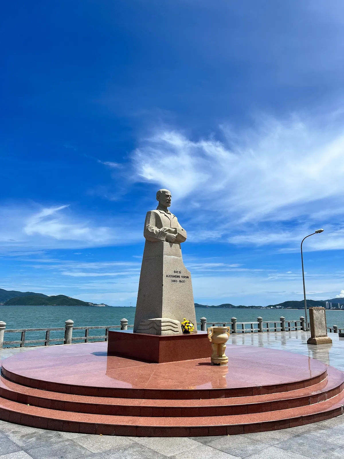
Alexandre Yersin park
Rating: 4.1 / 5 — Our own score, not an average of guest reviewsA seafront park at the north end of the city with his statue and memorial. Open all hours, free
North of the cityFree0.6 km away
Attractions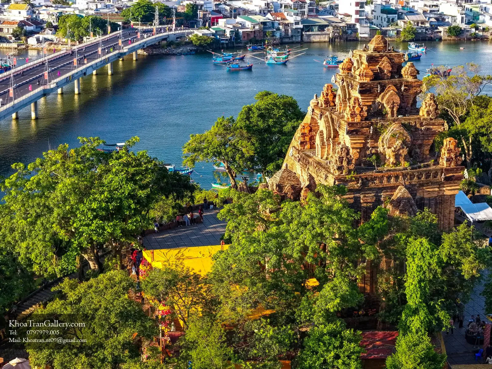
Po Nagar Cham Towers
Rating: 4.5 / 5 — Our own score, not an average of guest reviewsA 7th–12th century Cham temple complex, still an active place of worship
North of the city25,000 – 30,000₫/person0.8 km away
Eat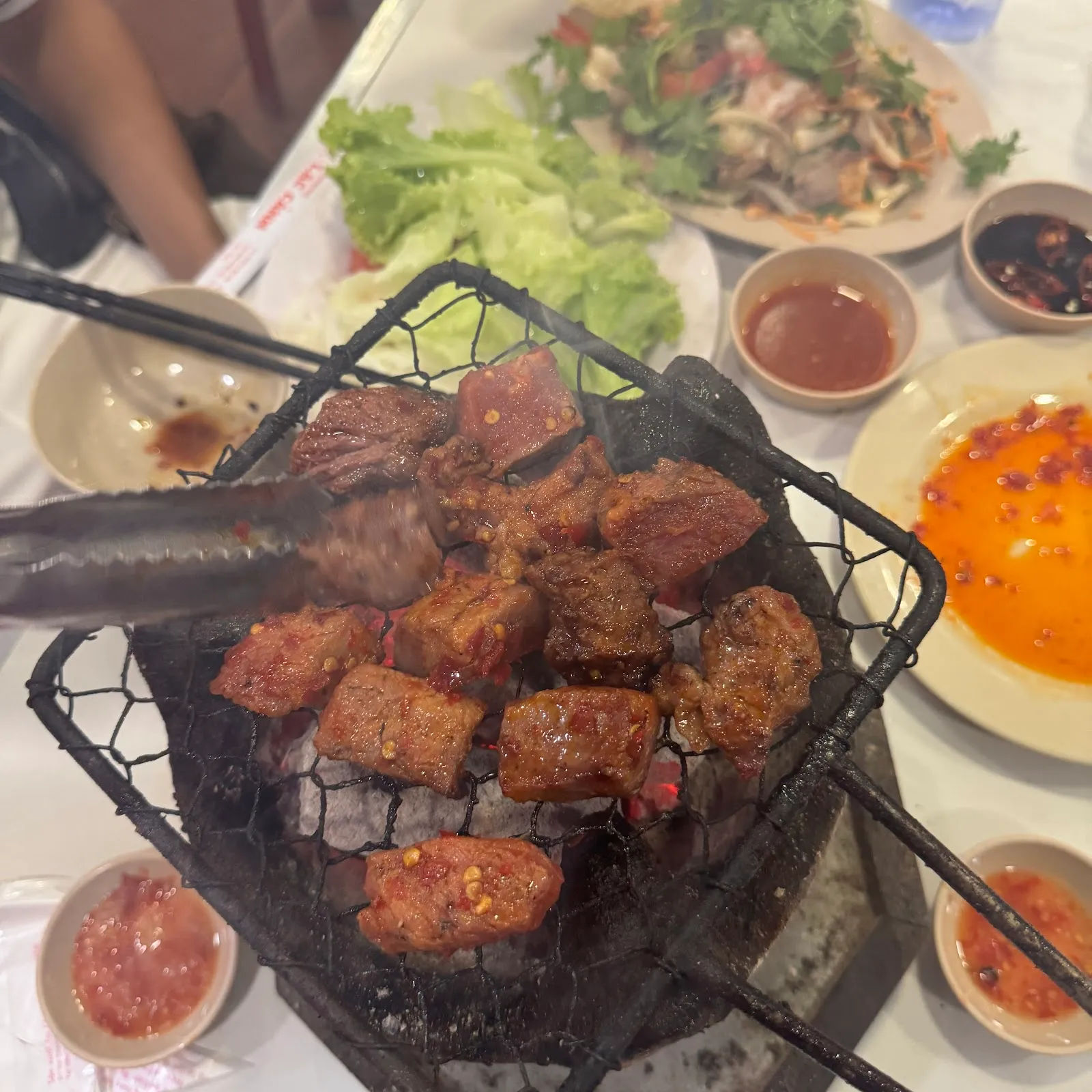
Lạc Cảnh grilled beef
Rating: 3.9 / 5 — Our own score, not an average of guest reviewsSixty-five years of grilled beef in Xuong Huan. What to order, and what to know first
City centre150,000 – 300,000₫/person